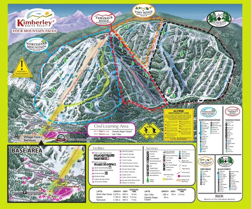
Kimberley trail map Skiing & snowboarding around Kimberley, British Columbia
Kimberley, at the base of the Monashee Range in the Okanagan Valley, B.C, is a very family friendly ski resort with around 75% of the pistes geared up for beginners and intermediate skiers and boarders.
Yet, Kimberley also delivers some steep and challenging terrain for the more advanced with deep powder bowls and black pistes around the Lake Gem area. Some of the Blue pistes are more like scary Reds on the European scale of difficulty as they are deliberately left ungroomed to make life a little more challenging.
One look at the Kimberley trail map says it all, lots of terrain for touring and deep powder bowls plus fantastic back-country off piste opportunities in total wilderness.
One of the best ways and least expensive ways to go ski touring is via snowcat - no need for your trail map here as your local guide will escourt you in to the unknown for an adventure to remember.
| Piste map information | |
|---|---|
| Black | 15 |
| Red | 15 |
| Blue | 34 |
| Beginner areas | 16 |
| Drags | 2 |
| Chair | 3 |
| Gondola | 0 |
| Cable car | 0 |
| Funicular | 0 |
| Railways | 0 |
| Slope direction | |
| Mountain restaurants | |
Snowmobile
No trip to Kimberley would be complete without having a go on a snowmobile. From beginners who prefer gentle groomed trails to advanced terrain, its an experience you won't forget.
The area known as Rolling Hills is the main starting point for family friendly trails. For the advanced and adventurous, armed with a trail map and guide, you can venture out to Hartley Lake and Ram Creek - avalanche equipment is a must!
Kimberley piste map

