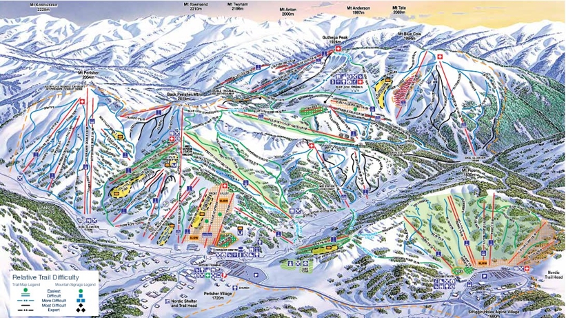
Perisher trail map Ski area & snowboarding trail map of Perisher Valley, New South Wales
The Perisher Valley ski area spreads across 7 peaks connecting the villages of...
- Perisher Valley
- Smiggin Holes
- Guthega, and
- Blue Cow
...and is the largest ski area in the Southern Hemisphere. The highest peak rises to 2054m giving a vertical of 334m.
One look at the Perisher piste map shows that the 105 ski trails are more suited to beginner and intermediate skiers and snowboarders.
- 22% beginner
- 60% intermediate
- 18% advanced
For advanced skiers, there are some very short black runs so the best option is to head off-piste or to the gladed sections of the lower slopes.
| Piste map information | |
|---|---|
| Black | 8 |
| Red | 11 |
| Blue | 62 |
| Beginner areas | 24 |
| Drags | 35 |
| Chair | 12 |
| Gondola | 0 |
| Cable car | 0 |
| Funicular | 0 |
| Railways | 1 |
| Slope direction | N,S,E,W |
| Mountain restaurants | 7 |
Perisher trail & ski area map

