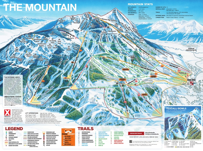
Crested Butte piste & trail Map Skiing and snowboarding in and around Crested Butte, Colorado
The Crested Butte ski map shows the terrain and trails around the mainly north facing mountain. Whilst not one of Colorado's largest ski areas, it has a reputation for some fantastic off-piste terrain for expert skiers and snowboarders. With names such as "Wolf's Lair's", "Body Bag" and "Dead End Chutes" it gives you an idea of how challenging some of the trails are.
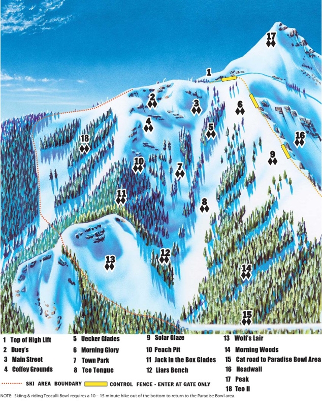
Teocalli Bowl provides 17 ungroomed itineraries that run down through the glades. Once at the bottom of the bowl, it takes around 10-15 minutes to hike out and return to the Paradise Bowl area.
For a long cruising run, try the 2.6mile leg burning trail that starts from Peak and ends at Treasury. This trail is suitable for intermediate skiers and above.
Crested Butte is also a great place for beginners. Not only is there an excellent beginners area at the base station but there are many inter-linked green trails from mid mountain that take you all the way back to the bottom.
| Piste map information | |
|---|---|
| Black | 28 |
| Red | 7 |
| Blue | 12 |
| Beginner areas | 11 |
| Drags | 2 |
| Chair | 10 |
| Gondola | 0 |
| Cable car | 0 |
| Funicular | 0 |
| Railways | 0 |
| Slope direction | N,S,E,W |
| Mountain restaurants | 13 |
Crested Butte trail & ski area map


